Condition: Good
State forestry reserve on the western side
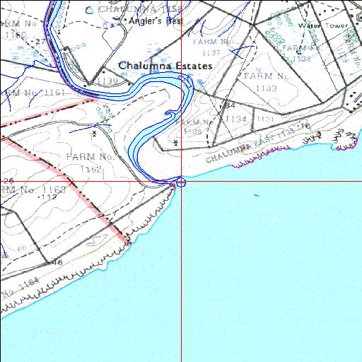
33o13'32"S 27o35'01.7"E
(-33.225567, 27.583816)
Map 3327BA
3820m wide x 4567m high
Cape Datum.
Surveys and Mapping.
Data from file
/iwqs3/tmp/riv/wes_akw-geo
| Tyolomnqa Temporarily open/closed estuary. | ||
|---|---|---|
|
|
|
|
|
Information: Poor Condition: Good State forestry reserve on the western side |
||
|
Locality: 33o13'32"S 27o35'01.7"E (-33.225567, 27.583816) Map 3327BA 3820m wide x 4567m high Cape Datum. |
||
|
Surveys and Mapping. Data from file /iwqs3/tmp/riv/wes_akw-geo |
||
| <--Previous | Home^ | Next--> | |
| SA Inst. for Aquatic Biodiversity | stmaphtml.aml 2003-09-04 - 14:45:20 | |