Condition: Excellent
Some of the floodplain has been used for subsistence agriculture
31o44'58.5"S 29o22'16.4"E
(-31.74957, 29.371222)
Map 3129CB
3884m wide x 4567m high
Cape Datum.
Surveys and Mapping.
Data from file
/iwqs3/tmp/riv/wes_akw-geo
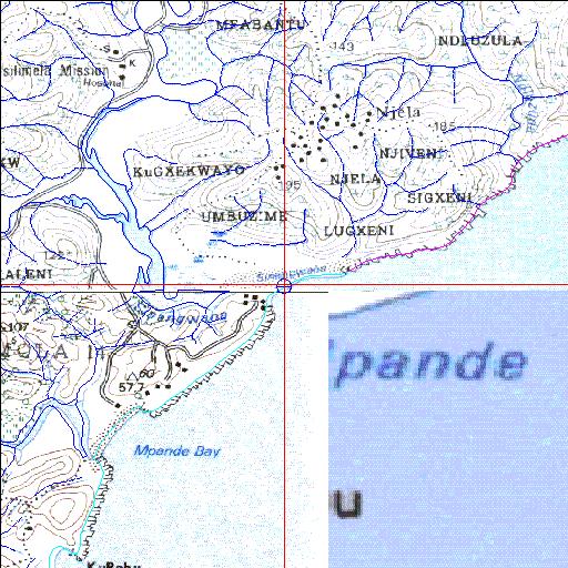
| Sinangwana Temporarily open/closed estuary. | ||
|---|---|---|
|
|
|
|
|
Information: Poor Condition: Excellent Some of the floodplain has been used for subsistence agriculture |
||
|
Locality: 31o44'58.5"S 29o22'16.4"E (-31.74957, 29.371222) Map 3129CB 3884m wide x 4567m high Cape Datum. |
||
|
Surveys and Mapping. Data from file /iwqs3/tmp/riv/wes_akw-geo |
||
| <--Previous | Home^ | Next--> | |
| SA Inst. for Aquatic Biodiversity | stmaphtml.aml 2003-09-04 - 15:40:33 | |