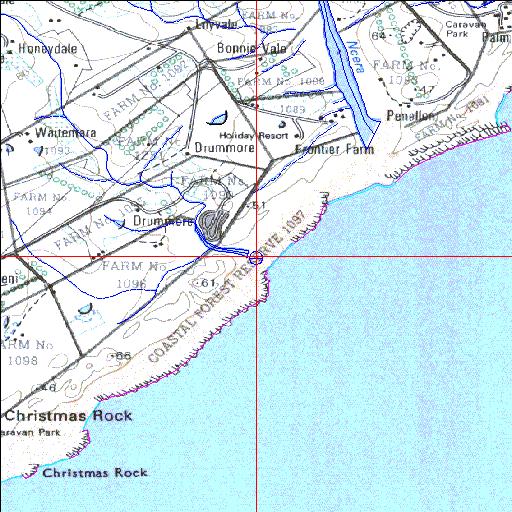
Condition: Good
Farmlands in the catchment and resort development to the east
33o10'35.8"S 27o39'31.9"E
(-33.176598, 27.65885)
Map 3327BA
3823m wide x 4567m high
Cape Datum.
Surveys and Mapping.
Data from file
/iwqs3/tmp/riv/wes_akw-geo
| Ross' Creek Temporarily open/closed estuary. | ||
|---|---|---|
|
|
|
|
|
Information: Poor Condition: Good Farmlands in the catchment and resort development to the east |
||
|
Locality: 33o10'35.8"S 27o39'31.9"E (-33.176598, 27.65885) Map 3327BA 3823m wide x 4567m high Cape Datum. |
||
|
Surveys and Mapping. Data from file /iwqs3/tmp/riv/wes_akw-geo |
||
| <--Previous | Home^ | Next--> | |
| SA Inst. for Aquatic Biodiversity | stmaphtml.aml 2003-09-04 - 14:47:09 | |