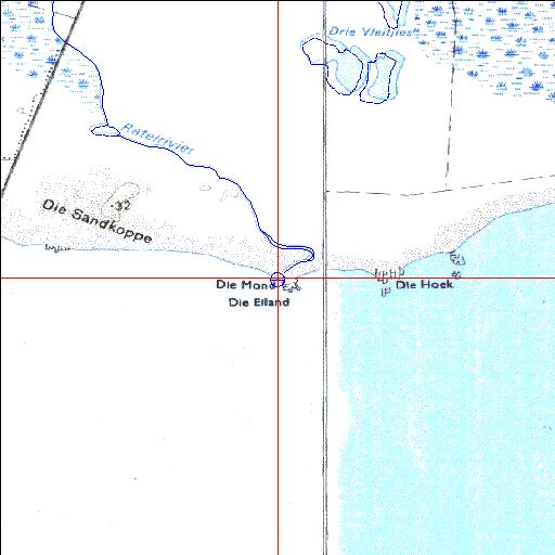
Ratel Temporarily open/closed estuary.
Ratel Temporarily open/closed estuary. Ratel position
Information: Poor
Condition: Good

Within a private coastal nature reserve but mouth has been diverted
Locality:
34o46'13.5"S 19o44'47.7"E
(-34.770412, 19.746585)
Map 3419DA 3419DB
3752m wide x 4567m high
Cape Datum.
South Africa DLA, DWAF 1:50 000 maps from
Surveys and Mapping.
Data from file
/iwqs3/tmp/riv/wes_akw-geo
<--Previous | Home^ Next-->
SA Inst. for Aquatic Biodiversity stmaphtml.aml 2003-09-04 - 13:44:27