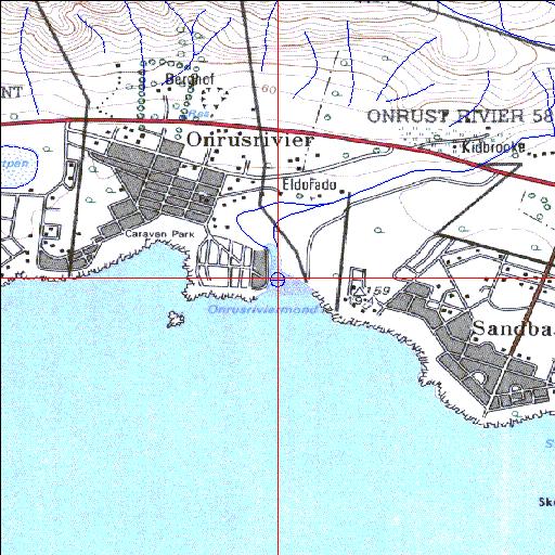
Condition: Poor
Siltation and reed encroachment but suitable for rehabilitation
34o25'07.1"S 19o10'47"E
(-34.41863, 19.179736)
Map 3419AC
3767m wide x 4567m high
Cape Datum.
Surveys and Mapping.
Data from file
/iwqs3/tmp/riv/wes_akw-geo
| Onrus Temporarily open/closed estuary. | ||
|---|---|---|
|
|
|
|
|
Information: Moderate Condition: Poor Siltation and reed encroachment but suitable for rehabilitation |
||
|
Locality: 34o25'07.1"S 19o10'47"E (-34.41863, 19.179736) Map 3419AC 3767m wide x 4567m high Cape Datum. |
||
|
Surveys and Mapping. Data from file /iwqs3/tmp/riv/wes_akw-geo |
||
| <--Previous | Home^ | Next--> | |
| SA Inst. for Aquatic Biodiversity | stmaphtml.aml 2003-09-04 - 13:41:18 | |