Condition: Excellent
May be considered for inclusion in a coastal reserve
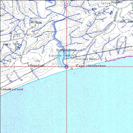
32o47'02"S 28o10'56.8"E
(-32.783901, 28.182441)
Map 3228CC
3840m wide x 4567m high
Cape Datum.
Surveys and Mapping.
Data from file
/iwqs3/tmp/riv/wes_akw-geo
| Nyara Temporarily open/closed estuary. | ||
|---|---|---|
|
|
|
|
|
Information: Poor Condition: Excellent May be considered for inclusion in a coastal reserve |
||
|
Locality: 32o47'02"S 28o10'56.8"E (-32.783901, 28.182441) Map 3228CC 3840m wide x 4567m high Cape Datum. |
||
|
Surveys and Mapping. Data from file /iwqs3/tmp/riv/wes_akw-geo |
||
| <--Previous | Home^ | Next--> | |
| SA Inst. for Aquatic Biodiversity | stmaphtml.aml 2003-09-04 - 15:02:10 | |