Condition: Poor
Encouraging signs of recovery from a severely polluted condition
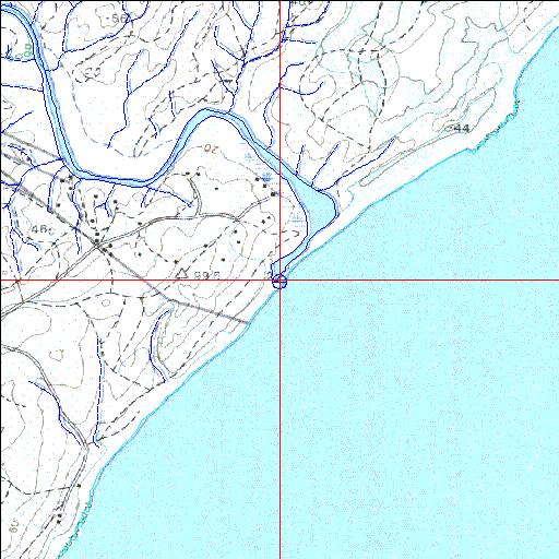
29o19'01.5"S 31o24'29.9"E
(-29.31707, 31.408293)
Map 2931AD
3982m wide x 4567m high
Cape Datum.
Surveys and Mapping.
Data from file
/iwqs3/tmp/riv/wes_akw-geo
| Nonoti Temporarily open/closed estuary. | ||
|---|---|---|
|
|
|
|
|
Information: Poor Condition: Poor Encouraging signs of recovery from a severely polluted condition |
||
|
Locality: 29o19'01.5"S 31o24'29.9"E (-29.31707, 31.408293) Map 2931AD 3982m wide x 4567m high Cape Datum. |
||
|
Surveys and Mapping. Data from file /iwqs3/tmp/riv/wes_akw-geo |
||
| <--Previous | Home^ | Next--> | |
| SA Inst. for Aquatic Biodiversity | stmaphtml.aml 2003-09-04 - 16:47:18 | |