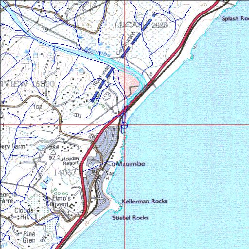
Condition: Poor
Siltation problems arising from severe erosion in the catchment
30o36'48.7"S 30o32'52.8"E
(-30.613537, 30.548005)
Map 3030DA
3930m wide x 4567m high
Cape Datum.
Surveys and Mapping.
Data from file
/iwqs3/tmp/riv/wes_akw-geo
| Mzumbe Temporarily open/closed estuary. | ||
|---|---|---|
|
|
|
|
|
Information: Poor Condition: Poor Siltation problems arising from severe erosion in the catchment |
||
|
Locality: 30o36'48.7"S 30o32'52.8"E (-30.613537, 30.548005) Map 3030DA 3930m wide x 4567m high Cape Datum. |
||
|
Surveys and Mapping. Data from file /iwqs3/tmp/riv/wes_akw-geo |
||
| <--Previous | Home^ | Next--> | |
| SA Inst. for Aquatic Biodiversity | stmaphtml.aml 2003-09-04 - 16:21:52 | |