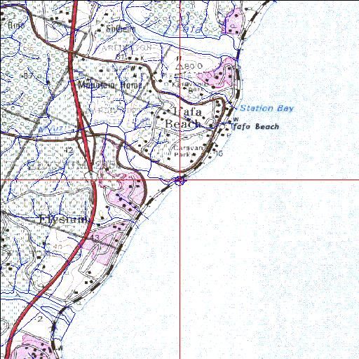
Condition: Fair
Mouth area has been modified by railway construction
30o28'08.1"S 30o38'49.6"E
(-30.468909, 30.647122)
Map 3030BC
3936m wide x 4567m high
Cape Datum.
Surveys and Mapping.
Data from file
/iwqs3/tmp/riv/wes_akw-geo
| Mvuzi Temporarily open/closed estuary. | ||
|---|---|---|
|
|
|
|
|
Information: Poor Condition: Fair Mouth area has been modified by railway construction |
||
|
Locality: 30o28'08.1"S 30o38'49.6"E (-30.468909, 30.647122) Map 3030BC 3936m wide x 4567m high Cape Datum. |
||
|
Surveys and Mapping. Data from file /iwqs3/tmp/riv/wes_akw-geo |
||
| <--Previous | Home^ | Next--> | |
| SA Inst. for Aquatic Biodiversity | stmaphtml.aml 2003-09-04 - 16:26:04 | |