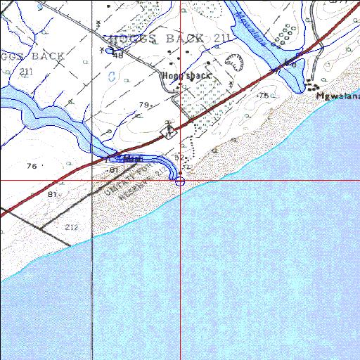
Condition: Excellent
New resort development near mouth
33o25'21"S 27o15'36.6"E
(-33.422491, 27.260167)
Map 3327AC 3327AD
3812m wide x 4567m high
Cape Datum.
Surveys and Mapping.
Data from file
/iwqs3/tmp/riv/wes_akw-geo
| Mtati Temporarily open/closed estuary. | ||
|---|---|---|
|
|
|
|
|
Information: Poor Condition: Excellent New resort development near mouth |
||
|
Locality: 33o25'21"S 27o15'36.6"E (-33.422491, 27.260167) Map 3327AC 3327AD 3812m wide x 4567m high Cape Datum. |
||
|
Surveys and Mapping. Data from file /iwqs3/tmp/riv/wes_akw-geo |
||
| <--Previous | Home^ | Next--> | |
| SA Inst. for Aquatic Biodiversity | stmaphtml.aml 2003-09-04 - 14:39:32 | |