Condition: Poor
One of the most degraded estuaries on the KwaZulu-Natal coast
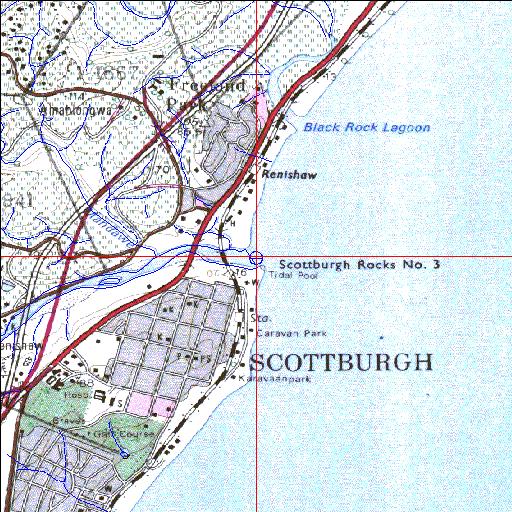
30o16'44.7"S 30o45'39.8"E
(-30.279097, 30.761043)
Map 3030BC
3944m wide x 4567m high
Cape Datum.
Surveys and Mapping.
Data from file
/iwqs3/tmp/riv/wes_akw-geo
| Mpambanyoni Temporarily open/closed estuary. | ||
|---|---|---|
|
|
|
|
|
Information: Poor Condition: Poor One of the most degraded estuaries on the KwaZulu-Natal coast |
||
|
Locality: 30o16'44.7"S 30o45'39.8"E (-30.279097, 30.761043) Map 3030BC 3944m wide x 4567m high Cape Datum. |
||
|
Surveys and Mapping. Data from file /iwqs3/tmp/riv/wes_akw-geo |
||
| <--Previous | Home^ | Next--> | |
| SA Inst. for Aquatic Biodiversity | stmaphtml.aml 2003-09-04 - 16:30:12 | |