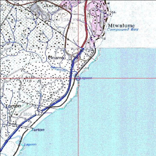
Condition: Fair
Impacts of road and rail construction are apparent
30o30'28.5"S 30o37'31.7"E
(-30.507908, 30.625463)
Map 3030BC 3030DA
3935m wide x 4567m high
Cape Datum.
Surveys and Mapping.
Data from file
/iwqs3/tmp/riv/wes_akw-geo
| Mnamfu Temporarily open/closed estuary. | ||
|---|---|---|
|
|
|
|
|
Information: Poor Condition: Fair Impacts of road and rail construction are apparent |
||
|
Locality: 30o30'28.5"S 30o37'31.7"E (-30.507908, 30.625463) Map 3030BC 3030DA 3935m wide x 4567m high Cape Datum. |
||
|
Surveys and Mapping. Data from file /iwqs3/tmp/riv/wes_akw-geo |
||
| <--Previous | Home^ | Next--> | |
| SA Inst. for Aquatic Biodiversity | stmaphtml.aml 2003-09-04 - 16:24:29 | |