Condition: Good
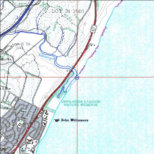
Estuary forms part of a nature reserve
29o42'14.6"S 31o06'03.1"E
(-29.704061, 31.100855)
Map 2931CA
3967m wide x 4567m high
Cape Datum.
Surveys and Mapping.
Data from file
/iwqs3/tmp/riv/wes_akw-geo
| Mhlanga Temporarily open/closed estuary. | ||
|---|---|---|
|
|
|
|
|
Information: Good Condition: Good Estuary forms part of a nature reserve |
||
|
Locality: 29o42'14.6"S 31o06'03.1"E (-29.704061, 31.100855) Map 2931CA 3967m wide x 4567m high Cape Datum. |
||
|
Surveys and Mapping. Data from file /iwqs3/tmp/riv/wes_akw-geo |
||
| <--Previous | Home^ | Next--> | |
| SA Inst. for Aquatic Biodiversity | stmaphtml.aml 2003-09-04 - 16:42:37 | |