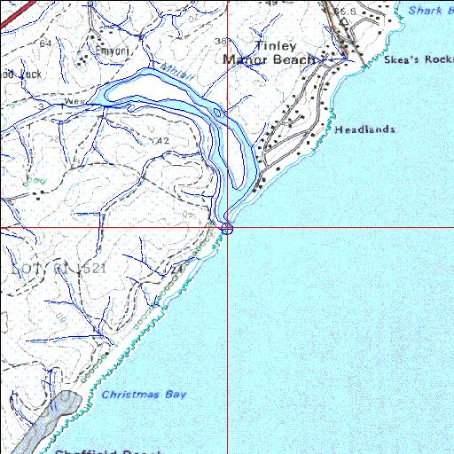
Condition: Fair
Problems include siltation and sugar cane encroachment
29o27'40.8"S 31o16'39.6"E
(-29.461328, 31.277672)
Map 2931AD
3976m wide x 4567m high
Cape Datum.
Surveys and Mapping.
Data from file
/iwqs3/tmp/riv/wes_akw-geo
| Mhlali Temporarily open/closed estuary. | ||
|---|---|---|
|
|
|
|
|
Information: Poor Condition: Fair Problems include siltation and sugar cane encroachment |
||
|
Locality: 29o27'40.8"S 31o16'39.6"E (-29.461328, 31.277672) Map 2931AD 3976m wide x 4567m high Cape Datum. |
||
|
Surveys and Mapping. Data from file /iwqs3/tmp/riv/wes_akw-geo |
||
| <--Previous | Home^ | Next--> | |
| SA Inst. for Aquatic Biodiversity | stmaphtml.aml 2003-09-04 - 16:44:53 | |