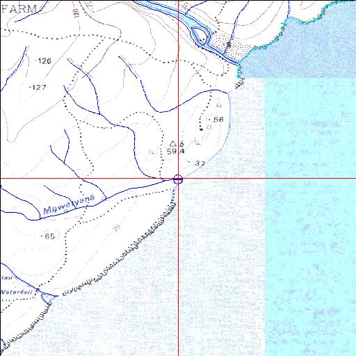
Condition: Excellent
Situated within the Mkambati Nature Reserve
31o15'41.6"S 30o02'24.3"E
(-31.261545, 30.040088)
Map 3130AA
3904m wide x 4567m high
Cape Datum.
Surveys and Mapping.
Data from file
/iwqs3/tmp/riv/wes_akw-geo
| Mgwetyana Temporarily open/closed estuary. | ||
|---|---|---|
|
|
|
|
|
Information: Poor Condition: Excellent Situated within the Mkambati Nature Reserve |
||
|
Locality: 31o15'41.6"S 30o02'24.3"E (-31.261545, 30.040088) Map 3130AA 3904m wide x 4567m high Cape Datum. |
||
|
Surveys and Mapping. Data from file /iwqs3/tmp/riv/wes_akw-geo |
||
| <--Previous | Home^ | Next--> | |
| SA Inst. for Aquatic Biodiversity | stmaphtml.aml 2003-09-04 - 15:55:26 | |