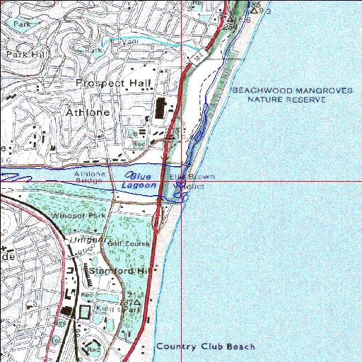
Condition: Fair
Catchment dams have transformed this previously permanently open estuary
29o48'35"S 31o02'27.4"E
(-29.809732, 31.040952)
Map
3963m wide x 4567m high
Cape Datum.
Surveys and Mapping.
Data from file
/iwqs3/tmp/riv/wes_akw-geo
| Mgeni Temporarily open/closed estuary. | ||
|---|---|---|
|
|
|
|
|
Information: Good Condition: Fair Catchment dams have transformed this previously permanently open estuary |
||
|
Locality: 29o48'35"S 31o02'27.4"E (-29.809732, 31.040952) Map 3963m wide x 4567m high Cape Datum. |
||
|
Surveys and Mapping. Data from file /iwqs3/tmp/riv/wes_akw-geo |
||
| <--Previous | Home^ | Next--> | |
| SA Inst. for Aquatic Biodiversity | stmaphtml.aml 2003-09-04 - 16:41:40 | |