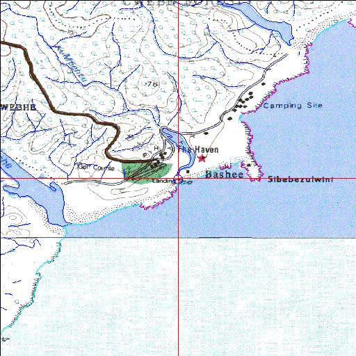
Condition: Excellent
Causeway crosses upper reaches of the system
32o14'35.5"S 28o54'50.5"E
(-32.243181, 28.914037)
Map 3228BB 3228BD
3863m wide x 4567m high
Cape Datum.
Surveys and Mapping.
Data from file
/iwqs3/tmp/riv/wes_akw-geo
| Ku-Mpenzu Temporarily open/closed estuary. | ||
|---|---|---|
|
|
|
|
|
Information: Poor Condition: Excellent Causeway crosses upper reaches of the system |
||
|
Locality: 32o14'35.5"S 28o54'50.5"E (-32.243181, 28.914037) Map 3228BB 3228BD 3863m wide x 4567m high Cape Datum. |
||
|
Surveys and Mapping. Data from file /iwqs3/tmp/riv/wes_akw-geo |
||
| <--Previous | Home^ | Next--> | |
| SA Inst. for Aquatic Biodiversity | stmaphtml.aml 2003-09-04 - 15:22:53 | |