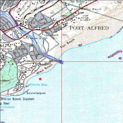
Condition: Fair
Lower reaches highly impacted by human activities
33o36'11.2"S 26o54'10.2"E
(-33.603118, 26.902821)
Map 3326DB
3804m wide x 4567m high
Cape Datum.
Surveys and Mapping.
Data from file
/iwqs3/tmp/riv/wes_akw-geo
| Kowie Permanently open estuary. | ||
|---|---|---|
|
|
|
|
|
Information: Good Condition: Fair Lower reaches highly impacted by human activities |
||
|
Locality: 33o36'11.2"S 26o54'10.2"E (-33.603118, 26.902821) Map 3326DB 3804m wide x 4567m high Cape Datum. |
||
|
Surveys and Mapping. Data from file /iwqs3/tmp/riv/wes_akw-geo |
||
| <--Previous | Home^ | Next--> | |
| SA Inst. for Aquatic Biodiversity | stmaphtml.aml 2003-09-04 - 14:32:43 | |