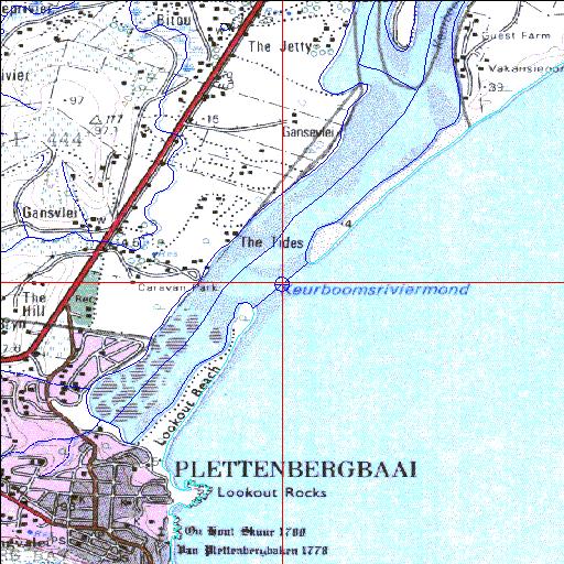
Condition: Good
Threat of a major dam on the Keurbooms River
34o02'17.8"S 23o23'12.7"E
(-34.038274, 23.386864)
Map 3423AB
3785m wide x 4567m high
Cape Datum.
Surveys and Mapping.
Data from file
/iwqs3/tmp/riv/wes_akw-geo
| Keurbooms Permanently open estuary. | ||
|---|---|---|
|
|
|
|
|
Information: Good Condition: Good Threat of a major dam on the Keurbooms River |
||
|
Locality: 34o02'17.8"S 23o23'12.7"E (-34.038274, 23.386864) Map 3423AB 3785m wide x 4567m high Cape Datum. |
||
|
Surveys and Mapping. Data from file /iwqs3/tmp/riv/wes_akw-geo |
||
| <--Previous | Home^ | Next--> | |
| SA Inst. for Aquatic Biodiversity | stmaphtml.aml 2003-09-04 - 14:03:04 | |