Condition: Poor
There is an urgent need to improve estuarine water quality
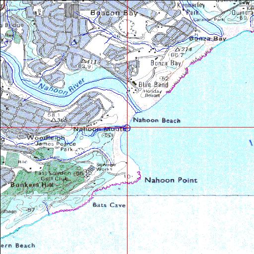
32o59'20.3"S 27o57'02.2"E
(-32.988971, 27.950601)
Map 3227DD 3327BB
3831m wide x 4567m high
Cape Datum.
Surveys and Mapping.
Data from file
/iwqs3/tmp/riv/wes_akw-geo
| Hlaze Temporarily open/closed estuary. | ||
|---|---|---|
|
|
|
|
|
Information: Poor Condition: Poor There is an urgent need to improve estuarine water quality |
||
|
Locality: 32o59'20.3"S 27o57'02.2"E (-32.988971, 27.950601) Map 3227DD 3327BB 3831m wide x 4567m high Cape Datum. |
||
|
Surveys and Mapping. Data from file /iwqs3/tmp/riv/wes_akw-geo |
||
| <--Previous | Home^ | Next--> | |
| SA Inst. for Aquatic Biodiversity | stmaphtml.aml 2003-09-04 - 14:53:24 | |