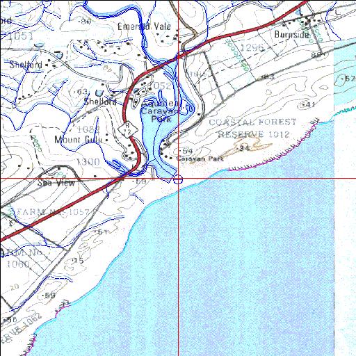
Condition: Fair
Fair proportion of estuarine floodplain comprises holiday resort
33o07'04.8"S 27o43'55.5"E
(-33.117989, 27.732097)
Map 3327BA 3327BB
3825m wide x 4567m high
Cape Datum.
Surveys and Mapping.
Data from file
/iwqs3/tmp/riv/wes_akw-geo
| Gxulu Temporarily open/closed estuary. | ||
|---|---|---|
|
|
|
|
|
Information: Poor Condition: Fair Fair proportion of estuarine floodplain comprises holiday resort |
||
|
Locality: 33o07'04.8"S 27o43'55.5"E (-33.117989, 27.732097) Map 3327BA 3327BB 3825m wide x 4567m high Cape Datum. |
||
|
Surveys and Mapping. Data from file /iwqs3/tmp/riv/wes_akw-geo |
||
| <--Previous | Home^ | Next--> | |
| SA Inst. for Aquatic Biodiversity | stmaphtml.aml 2003-09-04 - 14:49:27 | |