Condition: Good
Important environmental asset and recreational facility
32o55'59.9"S 28o01'59.9"E
(-32.9333, 28.0333)
Map 3228CC
3833m wide x 4567m high
Cape Datum.
Surveys and Mapping.
Data from file
/iwqs3/tmp/riv/wes_akw-geo
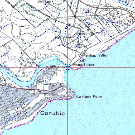
| Gqunube Permanently open estuary. | ||
|---|---|---|
|
|
|
|
|
Information: Poor Condition: Good Important environmental asset and recreational facility |
||
|
Locality: 32o55'59.9"S 28o01'59.9"E (-32.9333, 28.0333) Map 3228CC 3833m wide x 4567m high Cape Datum. |
||
|
Surveys and Mapping. Data from file /iwqs3/tmp/riv/wes_akw-geo |
||
| <--Previous | Home^ | Next--> | |
| SA Inst. for Aquatic Biodiversity | stmaphtml.aml 2003-09-04 - 14:56:36 | |