Condition: Fair
Remaining bayhead mangroves declared a Natural Heritage Site
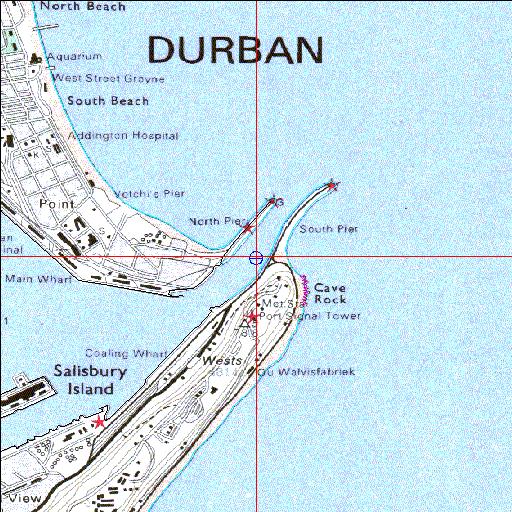
29o52'16"S 31o03'29.3"E
(-29.871117, 31.058151)
Map
3960m wide x 4567m high
Cape Datum.
Surveys and Mapping.
Data from file
/iwqs3/tmp/riv/wes_akw-geo
| Durban Bay Estuarine bay. | ||
|---|---|---|
|
|
|
|
|
Information: Good Condition: Fair Remaining bayhead mangroves declared a Natural Heritage Site |
||
|
Locality: 29o52'16"S 31o03'29.3"E (-29.871117, 31.058151) Map 3960m wide x 4567m high Cape Datum. |
||
|
Surveys and Mapping. Data from file /iwqs3/tmp/riv/wes_akw-geo |
||
| <--Previous | Home^ | Next--> | |
| SA Inst. for Aquatic Biodiversity | stmaphtml.aml 2003-09-04 - 16:40:41 | |