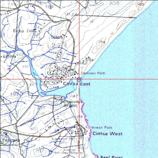
Condition: Good
Extensive resort development in the vicinity of the lower reaches
32o49'51.8"S 28o06'59.2"E
(-32.831066, 28.116442)
Map 3228CC
3838m wide x 4567m high
Cape Datum.
Surveys and Mapping.
Data from file
/iwqs3/tmp/riv/wes_akw-geo
| Cintsa Temporarily open/closed estuary. | ||
|---|---|---|
|
|
|
|
|
Information: Poor Condition: Good Extensive resort development in the vicinity of the lower reaches |
||
|
Locality: 32o49'51.8"S 28o06'59.2"E (-32.831066, 28.116442) Map 3228CC 3838m wide x 4567m high Cape Datum. |
||
|
Surveys and Mapping. Data from file /iwqs3/tmp/riv/wes_akw-geo |
||
| <--Previous | Home^ | Next--> | |
| SA Inst. for Aquatic Biodiversity | stmaphtml.aml 2003-09-04 - 15:00:05 | |